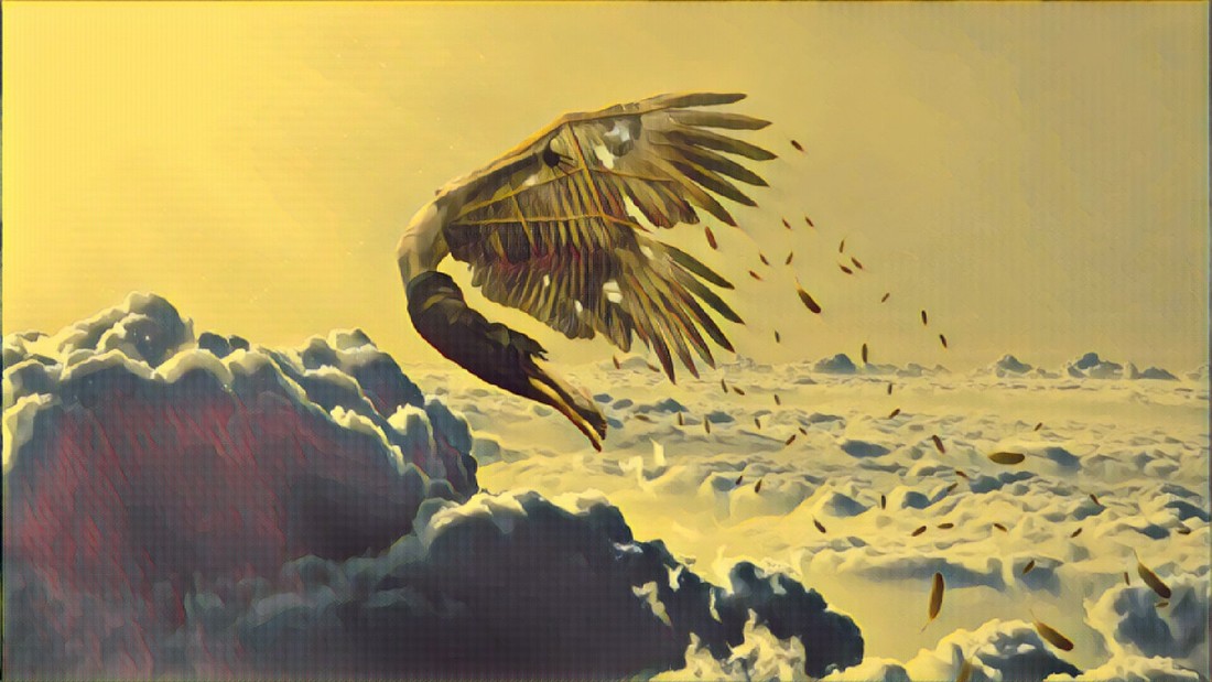
 OBBI 230630Z 35021KT 9999 COVAK 24/17 Q1015 In comfort, we ride aluminum tubes and strap ourselves for what is essentially a magic carpet ride. If observed from afar, these birds seem autonomous and mindfully intelligent. Curiously, the reality holds more wonder, than fiction can create.  Dial in the frequency, set destination, check the weather, check charts. These are basics of modern navigation, a complex three denominational matrix of interwoven sky routes. Human parcels shooting across an orchestrated heavenly ocean. With confidence, we hand ourselves over to people of the sky. It's comforting to know that thousands are watchful, ensuring the ease of our transit. Skilled with basic tricks rather than knowledge, Humans have traversed Terra Firma and it’s oceans for centuries. Remarkably, only with the structure of Science, did we confirm our oddly related discoveries. Curious observations by different cultures throughout the years, linked what we see above to guide our journeys below. With information bestowed and derived from generations beyond history, these skills became Knowledge. 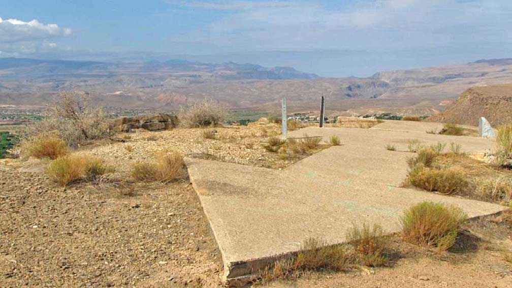 Gliding around the fields, early Aviators developed methods of utilizing familiar landmarks to help them navigate, a practice called Dead Reckoning. It gave us the confidence to take our first leaps to the sky, crossing valleys and reaching nearby towns. Bonfires were another simple trick to help pilots find their way. In Late February 1921, four D.H.4s took flight crossing the entire width of the United States. The journey was aided with managed Bonfires stretching from New York to San Francisco. It took them 34 Hours to complete the trip, and it was the precursor to the American Air Mail Service. The American Postal Service, later developed a system of large concrete ground arrows, to visually guide pilots to their destinations, later developed into Radio beacons. Still found and some even still being maintained, these are actual arrows, visually guiding pilots from New York to Chicago, then through to San Francisco. As Aviators came to conquer the skies, Aeronautical Regulations and Navigational Rules took cues from the path of our ancestors and adapted Maritime Law. The similarities were too obvious to ignore. Here was a proven system that can be easily adapted, and it started with Navigation. 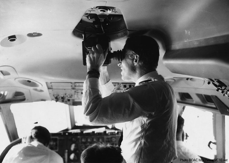 Imagine the turbulent rumble of a Sopwith crossing the desert. Reading the sky with nothing more than a Notebook, Map, Compass, Sextant, and Pen. Referring to crudely printed numbers, to get an idea of how far off course you might be?! How insane is that? Crazier still, is the fact that up until the 80’s, we had operational 747s and VC-10s, fitted with Sextant Ports as standard. Some even had periscopes and glass domes to accommodate for better navigation. Just imagine flying Bahrain to Cairo doing that! Continuing with the same logic, established Landing fields, adapted Maritime light beacons and paddles to communicate, and identify themselves. This is where we get our color codes for Military/Civil Airports beacon lights, Color Paddles, and Light Signals. Radio was mainly used for communication. Only after the beginning of the WWI did pilots use RDF [Radio Directional Finders] for navigation; which was basically a directional antenna dialed to the local commercial radio station. Flying from Paris to London, tune in to the BBC!  1920s America saw the introduction of the first ever Air Traffic Control system. It was basically established to guide and manage local area traffic, plus aid transit aircraft. Quickly developing into a network of controlled radio towers called AMRS [Air Mail Radio Stations], aiding aircraft across large distances. Soon after establishing a National ATC system in the 50’s, most AMRS were converted to FSS [Flight Service Stations]. If you ever had the pleasure of flying with FSS, these are some incredibly helpful people. They provide help and support noncommercial flights, alerting, guiding, aiding, and best of all ensuring everyone’s safety. Magnificently, we created large radio networks that stretched continents, linking Europe with Africa, Asia, and later the World. Developing radio from a simple point and follow, to altitude, latitude, directional, telemetric, and predictive.  RDFs gave way to Morse Code identifiable NDBs [None Directional Beacons], followed by VORs [VHF Omnidirectional Range]. Developing even more complex radio networks, with the introduction of Decca Nav, LORAN [Long Range Navigation], and Omega for global radio navigation. Then the Russians place a metal ball higher than anyone else, and Satellite Navigation is born. The earliest example of these satellites utilized large balloons that either transmitted or bounced radio waves. Smart but vulnerable. We think of satellites as these highly technical devices, that require a scientist to operate. In reality, it’s just a metal box with a radio. The big technical science part is placing it in orbit. The Satellite concept and use can be easily comprehended by a child, yet it took the best and brightest to overcome the technicalities. #HumansAreAwesome Never the less, development of this great orbital network, took a good 30 years before it was adopted in aeronautical navigation. 1989, saw the use of the first satellite navigation system, but It wasn't until 1994 that we had a truly global system to adopt. Merging Radio and Satellites, gave birth to Navigation aids such as RNAV [Area or Random Navigation, STAR [Standard Terminal Arrival Route], and now GNSS [Global Navigation Satellite System]. Allowing for even more precision, guiding us through the toughest approaches and weather. Due to the lack of ground reference, Astronauts use celestial navigation, utilizing the Sun and Canopus [نجم سهيل]. An advanced version of the Sextant along with some periscopes are used to triangulate approximate position. This method is still used as a backup to the complex navigational system, and Astronauts regularly practice this skill. More down to earth. Developed and produced in the mid-60s, the SR71, was a marvel that still baffles us today. With its MACH 3 Capabilities and Stealth Requirements, it was almost impossible to utilize radio signals for navigation. The aircraft was actually fitted with an advanced version of the Sextant and Periscope. It automatically tracks stars and other celestial objects to fugue out where it is.  We have a defiant nature within us that propelled our existence to new frontiers. As toddlers, we crave the unknown, hungry to see the beyond. Not even tales of Icarus can hold us back from exploring. We dominate the Land, control the Seas, conquered the Skies, and are at the edges of Space looking out. I wonder if we should worry about our wings? Or have we learned from our mistakes, and built them better?
0 Comments
Leave a Reply. |
38AB
The Aviator.. Flight Recorder
May 2019
Departments
|
 RSS Feed
Services |
Management |
Copyright © 2018 bahrainaviators.com
|